Posted by: Alex MacGregor | March 14, 2010

The Plunge Into Zimbabwe

We had a lovely couple weeks in Malawi, a country we found beautiful, friendly, and relatively hassle-free, but it was time to be moving towards our final destination in Southern Africa: Victoria Falls. We thought of taking the northern route through Zambia, but after hearing numerous accounts from Africans that the problems in Zimbabwe were over and it was okay to travel there, we decided to visit one of Southern Africa’s most embattled countries and booked a bus to Harare, Zimbabwe’s capital.

The tricky thing about this is that Zimbabwe’s economy completely collased just a year ago, charcterized by hyperinflation, food and gas shortages, political violence, and a tidal wave of Zimbabweans heading for the South African border. In order to have a safe arrival, we decided to play it safe and book a night at a nice hotel online, figuring we would find more reasonable accommodation the next day.

After a great night at the Crowne Plaza, we were surprised by our first daylight view of Harare to find a bustling place with a big-city feel. In fact, the flowering African trees and modern office buildings made this one of the prettiest cities to stroll in we had seen yet!

Unfortunately, the state of the economy soon became apparent to us. Central Harare has few restaurants, and those that still exist mostly just have sadza (the local starch) and meat, despite what their expansive menus might claim. We were hassled for money more frequently than in other countries, and encountered some extremely aggressive street kids. And the shopping malls in City Center were hit or mss: a couple were full of happy shoppers and storefronts, while others just had a store or two near the front of the mall, with lifeless, unlit corridors trailing into the distance.

The tragic thing about Zimbabwe is that the terrible state of the economy is only a feature of the last decade. You can still see signs of major corporations that have (or had) major operations in Zimbabwe: companies like Barclays, Apple, and Ernst & Young fueled the construction of modern skyscrapers the likes of which we hadn’t seen since Johannesburg. Zimbabwe was a success story.

And in addition to the modern side, Harare retains some of its British colonial charm from its days as Salisbury, the capital of Rhodesia–an era which only came to an end three decades ago.

Zimbabwe is famous for its balancing rocks, so we decided to take a trip to the rocks in Epworth. We had no information on how to get there, but the park entrance seemed to be on an arterial road on the south side of town, so we went to the minibus rank and asked around. Soon, we were on a minibus “combi” filled with locals, zooming towards the beautiful rock formations in the south suburbs.

The Epworth rock formations found their way onto Zimbabwe’s infamous trillion dollar series of bank notes, just before the Zim Dollar went out of use.

On the combi back from the rocks, we got a feel for the bizarre currency situation that is currently taking place in Zimbabwe. Most payments in the north part of the country take place in US Dollars. However, there is absolutely no American change in Zimbabwe. None. Instead, South African Rand coins are used in place of US coins. 5 rand is 50 cents, 2 rand is 20 cents, and so on. Which is fine, except the Rand/Dollar exchange rate is actually 7.5 to 1 or so. So when you get on the combi and the driver says the fare is 5 Rand, if you hand him a $1 bill, you receive 5 Rand as change, which is almost worth a dollar!

Then, to our complete shock, Zim Dollars are still used for certain transactions! Bizarrely, there is no exchange rate. It’s actually the bills themselves that have value. The higher bills tend to be traded at a higher rate, but the relationship is far from linear. We saw wads of ten Z$50,000,000,000 bills traded as equal to fifty cents (or five Rand, as cents don’t exist in Zimbabwe). The bills go up to Z$100,000,000,000,000, so a linear exchange rate would imply this note is equal to $100; in reality, the Z$100 trillion note was equal to about a dime when the Zim Dollar ceased to be.

The reason for all of this wild trading of Zim Dollars? Zim Dollars are now valuable when they are sold as souvenirs to tourists in Victoria Falls. The fact that Zim Dollars are synonymous with hyperinflation makes them nice souvenirs, which gives them value, which actually turned them into a more viable and stable medium of exchange than when they were officially used as money!

Back in central Harare, we also went to the National Botanic Gardens, with some beautiful African trees.

Although the economic situation made certain things in Zimbabwe difficult, the more disturbing issue is the government. In many larger businesses, you see President Robert Mugabe’s framed picture looking down over you. Stern signs and soldiers warn against taking pictures of sensitive areas, most of all the presidential residence.

You even get some of the unnecessary, bizarre, and confusing restictions in the botanical garden. Walking down a path signposted to the a lookout point, we saw this decrepit old sign jammed into a tree, at a 45-degree angle to the path.

And this sign, in the woods next to one path, with another path heading into the woods about 20 feet to the left of this sign.

Is there any reason for this besides to confuse tourists?

Posted by: Alex MacGregor | March 13, 2010

City Life in Blantyre

After spending a couple weeks without anything resembling the services of a big city, we were in desparate need of some services: internet, laundry, toiletries–all are very difficult to obtain in small towns and cities.

Since Blantyre, Malawi’s main busines and finance hub, was centrally located to a number of things we wanted to do, we decided it would be a decent place to take a break from the bush.

Before going to Mulanje we spent two nights here, and when we got back from hiking we spent another three nights–although these final days were mainly spent waiting for a bus to Zimbabwe. Over the course of our time there, we managed to get a great sense of the city.

Victoria Street–Blantyre’s main drag.

The CCAP Church, constructed by Scottish missionaries in the 1890s. Blantyre was designated a trading center by the missionaries, and it has served that function very successfully ever since.

The Mandala Manager’s House, a colonial-era house with nice gardens and a good cafe.

I wanted a side pouch added to my bag, so we hired Weston, one of the menders along Haile Selassie Road, to do the job. Weston also fixed a seam on Caroline’s skirt and repaired some jeans I tore getting out of a minibus.

Chinese food, at long last!

At our favorite Blantyre eatery, Kips, we had the aptly titled “Special Milkshake Chocchip (Amazing)”

We stayed at the lovely Henderson Street Guesthouse, located right next to the central bank.

The market.

When the largest bills a country prints are worth about $3, you need a giant wad of money to head out into the country for a couple days. I gave up on the idea of folding my wallet.

Shockingly expensive groceries at Shoprite. This bottle of sunscren would probably cost around $10 in the US, but here in Malawi it costs about $40. And it doesn’t end there: you can help yourself to a $10 bottle of Pantene Pro-V or a $13 bottle of hand sanitzer! The notion that Africa is a cheap place needs a HUGE asterisk.

Magic Obama Strawberry Flavoured Bubblegum!

Posted by: Caroline | March 13, 2010

Living Low-Tech on Mulanje

I used to say that completing my senior genetics thesis was the hardest thing I have ever done in my life.

But that was before I came to Africa. Here, the phrase seems to lose all meaning because each day brings a fresh soul-testing difficulty.

Not that these struggles are without their rewards. Although climbing the largest mountain in Malawi was the most physically draining task I have ever faced, the views–both of the top of the mountain and of the towns below–were well worth it.

Mulanje features a network of paths that link nine mountain-top huts. You can piece together a customized trail based on what village you want to start in and what kinds of walks you want to do on top. We decided to do a three-day hike so that we could ascend and have a break the next day to explore the surrounding area.

The path begins innocently enough, winding through rolling tea estates and past small streams.

Then the path becomes a phyiscal struggle through dense, sometimes sharp growth. I definitely regretted not wearing long pants today.

But even that was an annoyance hardly worth mentioning once we reached the steep, practically vertical granite path halfway up the mountain. Such an ascent seems like it would be difficult in the dry season; during the rainy season (in full swing now), the climb became close to impossible over the slick rocks. Unfortunately neither of us have any pictures from this part of the journey because we were so focused on merely surviving it.

Because of Mulanje’s slippery reputation, the first thing Malawians say when you tell them you’ve climbed Mt. Mulanje is, “I hope you had a guide!” Thankfully, we did have a guide–Juma, a tourism student–as well as a porter, Stanily, to lug our clothes and food for the next few days. How humbling to be out of breath and about to collapse after scaling an impossible granite face, and he is right behind you–basically sprinting up the mountain with a 25-pound bag on his back.

I wish I could say I felt some sense of achievement once we finally arrived at the top, but I had no time to even digest the accomplishment because an intense storm arrived. Suddenly we were soaked, and the wind was so powerful our skin looked badly sunburned at the end of it.

Finally–the cottage that would be our home for the next two nights!

The cottages are basic, with outhouses (NEVER EVER thought I would use one of those!) and bathing rooms where you pour heated water over yourself. Each has a caretaker who builds fires and heats water for you. As soon as we arrived–soaked and dispirited–our caretaker got a kettle going so we could have some tea.

Later I cooked our rice dinner over the fire.

The next morning, we went on walks to the Linje pools and a few waterfalls.

Alex near the Linje pools.

Crossing the stream to Linje.

We stopped at a nearby government hut where Juma and the caretaker explained the African game Bawo.

Waterfalls near the Lichenya hut.

We were luckily able to see the sunset…

… the day before had been too cloudy, and a storm that night led to the destruction of this outhouse.

We took the slightly easier Nessa path to descend and got to see (but mainly hear) monkeys along the way.

Shortly after seeing the monkeys, we heard people yelling and assumed they were in some sort of trouble. But Juma told us these are farmers who are scaring monkeys away from their maize fields, impossibly situated on the steep slopes nearly an hour’s slippery climb from the village below.

We also saw pineapple fields.

At the bottom of the mountain, we found ourselves in the village of Nessa. Everyone wanted to say hello to us, and we inadvertently disrupted a lively church service–children started crowding the door and spilling outside once they saw us. Malawian children love to yell, “WHAT IS MY NAME, WHAT IS MY NAME.” This was confusing at first–should I know your name?–but then realized they had just picked up on the wrong pronoun and wanted to know our names.

Finally at the bus stop–and with some cassava to eat, too!

Posted by: Alex MacGregor | March 3, 2010

Shire River Safari

After a couple days of relxing at the beach, it was time for another short-but-sweet safari!

Although Malawi isn’t exactly famous for game parks–unlike neighboring countries, Malawi is densely populated and lacks suitable habitat for some of the big game Southern Africa is famous for–we found a great safari opportunity at Liwonde National Park, along the Shire River.

The Shire River is an important waterway in Southern Africa. It drains Lake Malawi to the south and eventually meets up with the Zambezi River in Mozambique. David Livingstone intended upon sailing up the Zambezi but found it too difficult and chose the Shire River instead. He eventually stumbled upon Lake Malawi (which he called Lake Nyasa), setting the foundation for British colonization of Malawi (originally called Nyasaland).

Apart from the wildlife, we quickly discovered that the river itself was beautiful.

One reason this park was so appealing to us was accessability. Normally, safari parks are so remote from towns and cities that you pretty much have to set up your own transport into the park and pay whatever tour operators ask, which usually ends up somewhere north of $200 per person per day. However, this place is adjacent to the town of Liwonde, which has regular minibus access along one of Malawi’s major highways, allowing us to get almost all the way there on our own.

We stayed at the Hippo View Lodge, a riverside resort just up the street from town. We found that the place definitely lives up to its name; within a couple hours of arriving, we spotted a whole family of hippos just across the river. It turned out the warning signs aren’t for show!

The next day we went on a boat tour into the national park, and got up close with the hippos.

We also saw a fish eagle, waiting for a good chance to hunt.

Posted by: Alex MacGregor | March 1, 2010

The Perils of Mozambique

Warning: this post is heavy on travel tales, and short on pictures. If you mainly enjoy looking through the pretty pictures on this blog, you may want to scroll down to the next post.

After our great day of relaxing on the beach, it was time to hit the road again. The plan was to reach Malawi after three days of travel:
First, we would get from the beach to Nampula, the big city in the northern part of the country.
Second, we would take the train from Nampula to Cuamba, a small city near the Malawian frontier.
Third, we would hop on a bus the remaining distance to the Malawi border.

You always hear that travel in Northern Mozambique–particularly during the rainy season–is as rough as it is anywhere, but this sounds pretty straightforward, right?

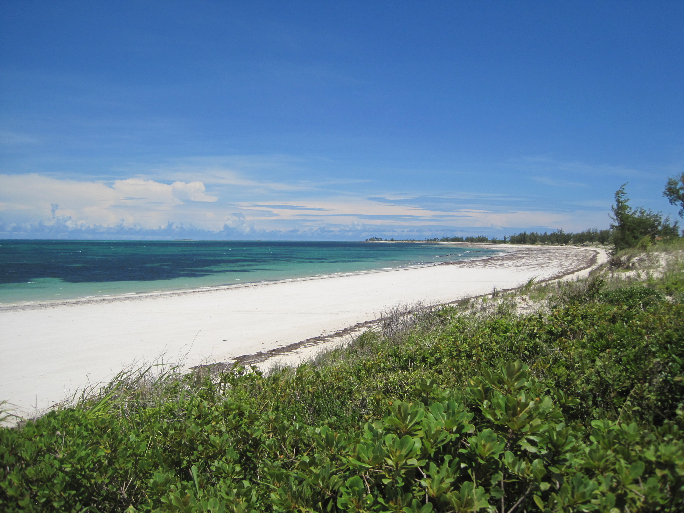
DAY ONE – Carrusca to Nampula

Our first task was to walk from the beach hut to the small town of Chocas, where we had loaded up on supplies a couple days before. We had previously learned that “chapas” (the Mozambican term for basic transport vehicle, which can describe anything from a proper minibus to, apparently, a small pickup truck) depart the town at 5AM and 7AM.

Realizing that we had a long hike along the beach with our packs beforehand, we opted to take the later chapa. After getting packed up and ready to go in the dark (no electricity that night) we set off. Walking on a beach is a nice feeling when you are carefree and have nowhere in particular to go, but when you are walking miles with a heavy load it is extremely difficult, and the hike took well over an hour.

We arrived at the market at three minutes to seven, and, sure enough, a small pickup truck soon showed up. We shared the back of the truck with other people and goods–the truck was filled with cement blocks, food, empty Coke bottles, and corregated tin.

So we set off down the dirt road to the main highway, from where we would have to find another chapa to take us the rest of the way.

The journey started out easy enough: stopping frequently to pick people and goods up, never going very fast–typical issues–until we came across something very unpleasant.

First, the other passengers began groaning and shuffling around. Then, we noticed that there were medium-sized flies all over us. At last, looking forward down the road, we realized we were driving through a thick cloud of these things that went on as far as the eye can see!

Flies were everywhere. All over the ground, our bags, crawling on our skin, hair, and clothes. We were frantically pulling them off of us but there were so many in the air that it was useless–more would come instantly. We turned to the other passengers and yelled “no peligroso?” (“not dangerous?” in Spanish) and gestured biting. They laughed and said no.

So at least they weren’t dangerous, but this went on for miles–probably 15 minutes we were stuck in this thick cloud of insects. Of course, after the cloud eventually died down the bugs were still everywhere. But we learned to live with the bugs, and by the end of the ride we could laugh about it (we still jokingly refer to it as the “plauge of locusts”).

Eventually we got to the turnoff on the highway and waited under the thatched bus stop. The purpose of the thatch isn’t to protect from the rain–it’s pretty much useless against that, as water just goes everywhere and turns everything into mud no matter waht you do–but rather as an escape from the ubiquitous African sun, which was already burning strong at 8AM.
After only a couple minutes of waiting, a new chapa–this time a significantly larger truck with an open bed–was headed in the direction of Nampula. We first said no–we were already sunburned and were not going to make it worse with two hours on this vehicle–but they were desperate for our business. I stipulated that if Caroline could sit in the cab, we would ride with them.

So we set off. I tried to count the people in the back of the truck with me; it was impossible to be accurate but somewhere near 35 people of all ages. I was terrified of falling off so I huddled on top of a bundle of corn in the middle and kept my weight low. I wore my rain jacket as a bonnet to keep out of the sun–when people looked at me oddly I said “quemar” (“to burn” in Spanish) and they seemed to understand.

The chapa was not direct to Nampula, it turned out, as we had to switch again in Monapo, a small city in between the Ilha and Nampula. After an very uncomfortable couple hours in a proper minibus (give me a truckbed anyday!) we were finally in Nampula.

Once at the bus station, we asked around about any transport headed to Cuamba–it was still before noon, and we thought it might be possible to make it all in one day–and people said we had to take the train which left at 5AM the next day. So we conceded that we would take the train, and spend the night in Nampula.

Nampula is not a great city. It doesn’t seem particularly unsafe, but the place just isn’t particularly inviting, with very few tourist services on offer. We could only find one internet cafe, which was government run, and, by our previous experiences with the internet cafes, not worth spending a minute or a cent at. The water at our hotel went out in the evening and never turned back on.The only flicker of enjoyment was eating a nice Portuguese meal at the Sports Club.

And off to bed without running water.

DAY TWO: Nampula to Cuamba

We set off the to train station at 3:30AM. Although things in Africa can usually not be counted upon to leave promptly, it seems you can never arrive too early for anything.

The train to Cuamba theoretically has First, Second, and Third Class seating. Unfortunately, the First Class seating hasn’t run in years. So you have Second and Third Class seating. Our only word of advice for the train was to avoid Third Class at all costs. “More crowded than a chapa,” we heard. When we walk into the train station at about quarter to four, what do we learn?
Of course, no Second Class today. No dining car either.

We were stuck. Brave the dreaded Third Class cabin or stay in Nampula another day? Which would mean going back to our hotel without water and trying to go back to sleep, only to repeat the whole 3AM fiasco tomorrow.

We made the flash decision to take the Third Class. I mean, how bad can it really be?

Of note, the train ride lasts, at the very least, 10 hours (to go a measley 300km or so).

We bought our tickets and walked cautiously into the pitch black railcar and found our way to an available seat.

Third Class really doesn’t deserve the dreaded reputation it gets, at least not the day we took it. The train never got extremely crowded–usually a seat or two was even available–and we stuck to the basics: never leave the seat, never go to the bathroom, keep your valuables tightly secured, and so on. The worst thing about the train was that the seat was a plank of wood just like a school desk–not so bad for an hour, but a pretty serious pain after ten hours.

Above is a picture I was able to snap at a big stop along the way, when everybody gets distracted by the rush of vendors trying to sell things through the window.

The big plus on the train is the landscape. Northern Mozambique is studded with hundreds giant granite domes resembling Stone Mountain.

After the tremendously long train ride (which would sometimes stop in the middle of nowhere for as much as half an hour), we arrived in the remote city of Cuamba at about 3:30PM.

Surprisingly, we were immediately pounced upon by people trying to get us into their chapa to go straight to the Malawi border! It seemed impossible–in a country where 12 noon was a late bus, a 3:30 departure was unheard of–but apparently plenty of people were headed to the border.

But, alas, after a whole day of not using the restroom or eating anything besides cookies we got from the market way back in Chocas, a three-hour plus ride to the border, arriving at an unfamiliar border town in the darkness, didn’t seem worth it. We would stay in Cuamba.

Cuamba was so sparsely populated it was pleasant. In a city without an inch of paved road, it felt like crime and other annoyances were impossible. We had a nice dinner and decided to wake up for the first chapa to the border, which was said to depart at 4AM.

DAT THREE: Cuamba to Malawi

After a rainy night, we boarded the minibus and took our seats. We felt that if we could make the border by 8AM we would have a good shot at making it to Lilongwe that day.

Unfortunately, the bus had no intention of departing at four. This was simply the time they began collecting passengers, which involved repeatedly touring the small city checking every pensao for passangers headed to Malawi or the remote north of Mozambique.

After two and a half hours of riding around on Cuamba’s horrible, bumpy streets–we were already completely jaded from being crammed on the bus so long–we finally departed.

The dirt road to the border was a horror. The rain from the night before had left it potholed and rutted. 30km/h was smooth sailing, and we were packed very tightly. Caroline had an especially unfortunate position, in the back corner of the minibus over the wheelwell.

The areas we passed through were incredible. Towns with no sign of modernity besides perhaps a wayward shipping container. Huge numbers of people walking along the road, with the minibus always honking to alert them to make way. We passed maybe a dozen vehicles going in the other direction. This portion of the trip was more remote and off the beaten track than I could have imagined. It took so long that we conceded we would not be able to make it to Lilongwe that day, but instead we would spend the night at Monkey Bay, on the shores of Lake Malawi.

Eventually we were dropped at the border town of Mandimba. It’s always a bit iffy whenever you’re dropped off at a border. But when you’re a white person and you’re some of the only people getting off the bus at that stop (most were continuing on for the long haul to the far north of Mozambique) it is downright chaotic. We were surrounded by people frantically offering us bike taxis and money exchange, both services we were in need of.

My strategy in this situation is to pick a trustworthy guy with a decent price and try to get him on your side, so hopefully he can get the others to back off.

I was successful in picking an honest money changer. After negotiating the deal in Portuguese (the last I would have to speak!), I traded my 1150 Meticais for 6050 Kwacha. The exchange rate was actually better than I thought the fair rate was, so that turned out to go reasonably well.

The bike taxis were next. We were quoted 50 Meticais ($1.50) was the going rate to the border post, 7km away, which sounded like a fair deal. I told him 100 Maticais for the both of us, and he could choose his friend to take Caroline.

So we set off on the bike taxis. The first part of the ride was rather pleasant–we were out in the countryside, kids waving, with scenery going by. We arrived at the Mozambique border post and I tried to pay the bike taxis. They said no, there was still further to go, and I thought that was rather honest of them not to simply take off with the money. The Mozambique border formalities went over fine.

We got back on the bikes and started off again. After a moment on the bike, the driver said the next segment would be an additional 1,000 Kawcha ($6), now that we were in Malawi.

I told him to stop. I asked him how far, and he said it was 6km farther to the Malawi border post. I confirmed that he said 1,000 for both, and he said yes. Even though I knew there was no good reason the price should double for the second segment of the journey, I begrudgingly accepted and we started.

After a while longer on the bike, he said it would actually be an additional 1,000 Kwacha each. Ahh, so we are at the heart of the scam: take the tourists halfway, then quadrouple the price for the second half once you’ve set off and they have no other option. I was furious. I told him no, I’m not paying that, as it was different than what was agreed to. He said I was mistaken. I said no, I’m not paying that much and that was final. He didn’t say anything else.

When we finally made it to the Malawi border post and I was thoroughly steamed I handed him 1000 Kwacha and 100 Maticais in a wad and stormed off toward the customs post. I half expected him to take issue with the payment and yell at me, in order to cause a scene in front of the border guard. I knew in this instance I would have no choice but to pay him the outrageous price.

But he seemed okay with the total payment–which is probably triple the normal cost for a bicycle taxi ride of that length–and we went through to the Malawi side and freed ourselves of the whole situation.

Walking into Malawi was a breath of fresh air. English signs, paved roads, and beautiful scenery welcomed us into the “Warm Heart of Africa”, as it’s called.

Unfortunately, we were instantly ripped off by a pickup driver. But this one was at least honest and didn’t leave me angry like the bicycles. He basically said that in order for his pickup to go, we had to pay him 1000 Kwacha each for the 60km ride to Mangochi. This is probably triple what the locals pay. He knew the white people crossing the border would be forced to take his transport to get to the next city, and that he would be willing to wait all day until we agreed to his price. I said we would pay it as long as we could sit in the front, and immediately a bunch of locals hopped in the back and we were off. At least this one was an honest rip off.

The ride to Mangochi was stunning. Kids ran alongside the car screaming “Muzungu!” (“White Person!”) as we passed through the highlands and eventually descended towards Lake Malawi. Also, since we paid such a high price for the ride, we were given great service by the driver–he even took us across the town of Mangochi and helped us find our next bus!

By now it was past noon and we had 8 hours of travel behind us. But we were finally on the bus to Monkey Bay in beautiful Malawi!

I should note that, while the situations described in this post were sometimes extremely frustrating and uncomfortable, we never actually felt threatened or in any real danger at any point. Most of the people we came across were very friendly ahnd helpful, and the journey went smoothly.

Posted by: Caroline | February 25, 2010

Most Stressful Day of Relaxation Ever

Although the Ilha has some nice beaches, we read in our guidebook that the place to go for the quintessential Mozambican beach experience was across the Mossuril Bay. It detailed two transport options: charter a boat for $20 or take the public dhow for 20 cents. Tough call, right?

We spent much of the afternoon searching for this 20 cent dhow or anyone who would tell us its departure point or time. I forgot to mention in my last post that the only word we might have heard more than caneta is “boat.” Everyone either knows someone who has a boat or owns a boat himself, so clearly no one was going to be honest with us about the dhow when they had a potential profit standing in front of them.

So we caved to the 20 dollar sailboat ride with Raymundo–although, due to the weather, this transformed into a rowboat ride. Even paying an exorbitant rate didn’t excuse Alex from having to row some himself.

We thought the hour-long ride across the Mossuril Bay was the bulk of our journey to the beachside Carrusca. How wrong we were…

Raymundo hopped off the boat and led us through this tiny village, which seemed to have as many goats as it did people.

The pictures are all of Alex because I think he was too miserable to take any photos himself.

We estimate we did at least three miles of trudging through mud and marsh to get to Carrusca, which is doubly difficult with all your belongings on your back (I cheated; Raymundo carried most of my stuff while I carried the day packs). We began to seriously reconsider if all of this effort was worth it.

But once we arrived, we thought it was.

Carrusca is made up of seven bungalows just meters from the beach.

By the way, I’d like to personally thank President Obama for our stay here. A faulty ATM on the Ilha meant we basically only had US dollars to spend, and the staff was reluctant to accept them until one of the Mozambican visitors pointed out that we were from the country where Obama was president.

Even though our all-morning journey sapped our energy, we were excited to relax by the Indian Ocean–until we heard that the Carrusca restaurant would be closed the next day. Our only option was to try to stock up on essentials in the neighboring village of Chocas.

“Neighboring” is a stretch. Although we could see the village from Carrusca, it was an arduous hour-long hike across the beach and through the community to its market.

One of the typical houses in the community:

When we arrived in the market, we didn’t see the baskets of tropical fruit I expected. The major product seemed to be clothes, and food was mainly limited to staples we couldn’t make use of without a stove. We settled for a bag of cookies, some rolls, and some juice mix packets. Thankfully we had enough Mozambican currency to get a little food from the restaurant to save in the fridge for the next day, too.

Did we walk twenty miles today? I felt like it.

One thing that lifted my spirits on our return journey: goats on the beach! (This if for you, Mom.)

Now, we could finally enjoy the ocean. And that’s all we did the next day– no more hiking.

Posted by: Caroline | February 24, 2010

Ilha de Moçambique (or Ballpoint Pen Island)

After our frustrating evening with the police in Maputo, we spent Valentine’s Day flying to Nampula (our Linhas Aéreas de Moçambique breakfasts even included heart-shaped chocolates — would you get that on Delta?) and getting to the small and remote Ilha de Moçambique. We caught a minibus from Nampula through a countryside covered in granite mountains and police checkpoints (we were stopped five times over the course of a three-hour ride).

The Ilha was the colonial capital of Mozambique before it was moved to Maputo, and Portuguese influence is still evident in the architecture of Stone Town on the northern side of the island.

On the southern side, Makuti Town has more of an African village feel.

Although the Ilha is a World Heritage Site, we encountered few other tourists. Ilha residents often seemed suspicious or at least surprised to see us, but a few “Bom dias” (good mornings) smoothed things over quickly.

Children are the only true indicator that tourists do actually come here (besides an adorably small tourist information desk). Apparently tourists of the past have showered these kids with canetas (pens) because they all expected some from us. We couldn’t give them canetas, but we could take their photos — which was so exciting for this boy that he wanted to see what it looked like before we even finished taking it.

Views from our favorite restaurant, Reliquias

Reliquias had some amazing prawn curry with coconut milk-soaked rice.

The Ilha at work and play

A beach on the north end of the island

Entrance to the island’s hospital

Posted by: Alex MacGregor | February 23, 2010

Two Nights in Maputo

Following our great stay in Johannesburg and wonderfully comfortable trip in South Africa, it was time to head to a place where a comfortable trip is almost impossible–Mozambique. We would first arrive in Maputo, the sprawling capital, from where we would soon catch a flight to the rural north of the country.

After a bit of a scramble off the bus, we finally found a hotel just off Av Karl Marx.

Our hotel’s antique elevator. You have to push the correct knob and pull all the others back to have any chance of landing on the correct floor. Still, you pretty often find yourself stuck in between levels or just on the wrong floor altogether. I learned eventually that the hotel employees don’t even bother with the buttons–they just jam the emergency stop button when they want to get off.

Unlike most African cities, Maputo is a city of high rises–mainly owning to its cosy relationship with the USSR after independence from Portugal.

Even if the country did go a bit wild building monolithic concrete highrises, a good amount of (sometimes crumbling) Portuguese colonial architecture remains.

The train station, designed in part by Gustave Eiffel’s firm:

Maputo’s markets. It’s not a good idea to go into the last one if you plan on eating chicken anytime soon.

The cathedral.

Surprisingly, there is enough of a tourist presence to warrant a Saturday craft market, with some nice art on display.

All in all our time in Maputo was eye-opening and fascinating, although definitely frustrating at times. The heat was immense and communication was difficult (our strategy was to try to pass Spanish for Portuguese, which had mixed results). Things that would normally take a minute elsewhere, such as acquiring a bottle of water, could turn into a lengthy process.

But the worst quality was the police. We’ve been in countries where the police have a reputation for looking out for themselves before the general public, but in Maputo we were stopped twice by police within a couple hours asking to examine our passports.

The first time we did not have them (who wants to carry around a passport at night?), and the police gave us a very hard time. “To sort this out we need go to the police station.” “I think you jumped the border.” (Ahh, yes, because I want to be in Maputo just that much!) And so on with his nonsense.  Thank god Caroline made herself start crying (far and away the best thing you can do in this situation) and he eventually gave up (“Don’t worry…is not a crime. Is a mistake!”) without getting anything. And the next time we were prepared, shocking another police officer as I pulled the passports from my leg moneybelt (something a properly-trained police officer never would have let me do).

So in order to protect the Mozambican state from foreign spies and criminals posing as tourists, the government passes a regulation that gives police a free ticket to shake down what few tourists do make their way there and that lets all the crooks know that tourists always have a passport on their person. What a wonderful rule!

Posted by: Alex MacGregor | February 23, 2010

Around Joburg

After our awesome safari experience, we were able to make a couple great day trips around the Johannesburg area with Karen’s help.

First, we went to the Cradle of Humankind, an archeological site.

The tour includes what appears to be an impressive set of caves, discovered (and exploited) by miners during Johannesburg’s gold rush era. The cave shows lots of damage from the early miners.

But the real importance of this particular cave lies in the gaps and openings to the surface.

As various lifeforms–especially prehumans–evolved in Africa, certain ones would by chance fall into holes just like this one, where they would die. Conditions happened to be just right for fossilization to occur, making this a perfect sort of time capsule for prehumans. One such prehuman is completely intact, making it an unprecedented waypoint for figuring out how the process of human evolution occured.

Plus, the museum included all sorts of things you’d probably not see displayed so boldly in the States!

We also went on a Soweto Township tour.

Soweto (an acronym for Southwest Township) is an area of the city used by the apartheid government to relocate blacks from Johannesburg’s city center. The township is still a very important cultural force in South Africa, including millions of people of various economic levels and a fair amount of South Africa’s political elite.

But the area still remains largely poor. Surrounding the organized township areas (most of which were build initially by the apartheid government and have been formally owned by the inhabitants since the 1990s) are informal settlements.

In addition to the modern dynamics of the area, the tour also went in depth into the history of the neighborhood. The area was home to the likes of Nelson Mandela and Archbishop Desmond Tutu.

In 1976, Soweto became famous when students rebelled against Afrikaans language school instruction, provoking the government to use violence against the unarmed teenagers and inciting riots across the country and that marked the beginning of the end of apartheid.

The cooling tower on the right has been painted to tell the story of Soweto.

Posted by: Caroline | February 11, 2010

Safari in Pilanesberg

A million thank yous to Amy Rogers, who suggested Pilanesberg based on a friend’s recommendation. Although Kruger is the gold standard for a South African safari, we wanted something a bit closer to Johannesburg. Pilanesburg, situated in a long-dormant volcano 100km from Johannesburg, seemed perfect. Our charismatic tour guide, KG, picked us up in a 4×4 for our tour — with no other tourists along, which was a lovely surprise.

Even when the animals weren’t around, the landscape was enough to keep us captivated.

(Finally — the elusive eland!)

Unfortunately we could not get any closer to these white rhinos.

KG bet me 20 Rands to dip my toes in the water next to the hippos. Since I am here writing this blog, I think you all know whether I took him up on the offer …

Pumba

One of the main reasons I was so excited about the safari was a bonus trip to the lion park nearby. The online description of the tour indicated that we would go around lunchtime, when the heat is so unbearable that the safari animals seek the shade and are harder to spot. So when our guide dropped Alex and me off at some picnic tables inside the park, I began to get a bit worried that I had misread the web site. When we got back into the 4×4, I asked if the lion park visit was a component of our tour. “No, that’s a different tour,” he said. “350 Rand.” I tried not to show my disappointment, but apparently it was visible because he asked, “Oh, no! That’s not why you booked the tour, is it?”

He told us he needed to get some lunch for himself before returning for the next round of wildlife watching, so we drove several miles outside of the park. I was trying not to mope too much. Then, all of a sudden, I saw signs reading LION PARK. I thought maybe it was just a mistake. But the massive lion statue in front of the park was too obvious. It turns out our tour guide is quite the trickster. He said he likes for the visit to be a surprise. It worked; I was far more excited than I was before!

The park serves as a rehabilitation center for abandoned cubs. They are bottle-fed, taught to hunt, and eventually reintroduced to the wild.

You couldn’t wipe the smile off my face for hours afterward. I never thought I would hold a lion!

Just when we thought our day was over, we got a great send-off from this lion in the wild, too!

Even though we’re not normally bird-watchers, the multitudes of vibrantly-colored birds in the park were intriguing to watch.

We were really lucky to see so much wildlife during “off-peak” sunshine hours.

« Newer Posts - Older Posts »

Categories